Self-similarity of watershed lines
The concepts of catchment basins and watersheds arise naturally in the field of Geomorphology, where they play a fundamental role in e.g. water management and landslide and flood prevention. These concepts also find important applications in seemingly unrelated areas such as Image Processing, Medicine and Physics.
The statistical properties of watershed lines are analyzed for natural as well as artificially generated Digital Elevation Maps. By using efficient numerical algorithms, the calculation of watersheds on systems comprised of 108 sites can be attained in a few cpu seconds.
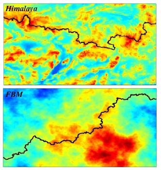
We find that the watershed between two far away oceans in a uncorrelated random-height map is a fractal with mass dimension Df = 1.211 ± 0.001. When calculated for natural landscapes of mountainous regions, the watersheds also display self-similar properties over intermediate to large spatial scales, but with smaller fractal dimensions due to long-range correlations.
In the cases of the Alps and Himalaya, for example, we obtain Al Hi Df = 1.10 ± 0.01 and Df = 1.11 ± 0.01, respectively. Finally, we show that synthetical topographies generated with similar spatial correlations can reveal watersheds with fractal properties close to those occurring on natural landscapes.